


Garmin BlueChart G3 Chart - English Channel - EU001R
Click to enlarge

Code: 1
MPN: EU0001R
Delivery Information
Currently we only deliver to the UK (inc. Northern Ireland), Channel Islands, Norway, Australia, New Zealand, Canada and USA for online ordering - please contact us on sales@bottomlinemarine.com if you live elsewhere.
Free shipping on UK orders over £75 (£5.95 for UK orders under £75)
Excludes certain heavy items
All prices include UK VAT - No customs or duty fees for UK orders
Description
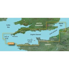
Garmin G3 BlueChart EU0001R
English Channel
Bluechart G3 is marine cartography exclusively for Garmin plotters.
BlueChart data will typically include detailed marine charts with shaded depth contours, inter tidal zones, spot soundings, wrecks, navaids, port plans, restricted areas, cable areas, anchorages and much more.
Additionally, Bluechart includes information from the paper chart used in the digitisation process such as chart number, name. scale, revision date and Notice-to-Mariners updates.
There are three formats of cartography: Garmin Bluechart, Garmin
Bluechart G3 and Garmin Bluechart G3 Vision. (The chart offered in this listing isGarmin Bluechart G3)
Original BlueChart is now largely discontinued as it was orientated for use in some of the early Garmin products such as the Map192 and Map198.
All of these chart plotters have had upgrades made available which are downloadable from the Garmin website to make use of the later BluechartG3 cartography.
Bluechart G3 was re-designed in 2009 to feature smoother layering and better integration of map graphics, for easierpanning, scrolling and zooming.
It features richer colours and shading for easier interpretation and improved visibility.
It also offers a choice of "mariner's view" map perspective or the familiar 2D direct overhead view to make chart reading and orientation easier.
These views are plotter dependent all the current models will support this feature.
The cartography is object orientated which means you can pan to an object on the map and instantly view information about that point - eg. the light characteristics of a buoy or navigational aid.
If you need any further information, please get in touch.
Specification List
| Type | Chart |
|---|